Waste Dialogues at Wreck Beach
- Year
- 2025
- Course
- DES 302
- Location
- Wreck Beach, UBC, Vancouver, BC
- Program
- Site analysis - organic and inorganic waste cycles
- Note
- Scale bars are not applicable
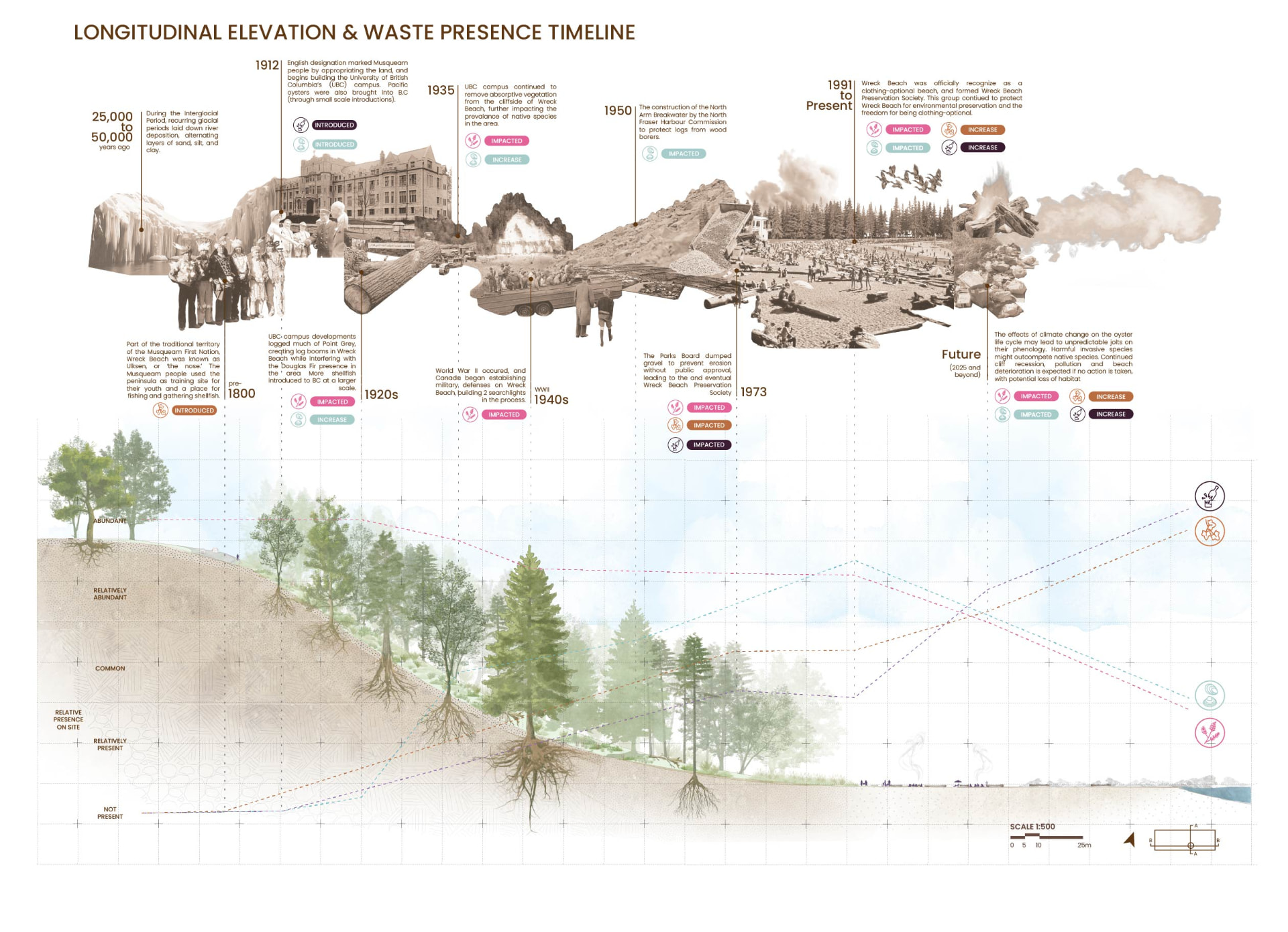
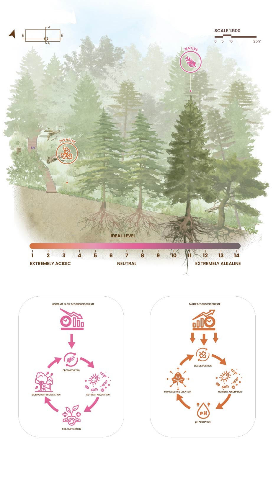
Wreck Beach is part of the traditional territory of the Musqueam First Nation, known as Ulksen, or the nose. This study reads the site through its waste, treating deposition as a dialogue between ecological and anthropogenic cycles. Context mapping, waste mapping, and site axonometrics locate where material gathers and what puts it there, from beach fires and foot traffic to motorized boating. A longitudinal elevation traces waste presence from 25,000 years of glacial deposition through UBC's 1912 campus construction, mid-century log booms, and the 1973 formation of the Wreck Beach Preservation Society, while a transverse elevation reads soil pH, decomposition rates, and the competing cycles of native and invasive species. The analysis became the ground for RE:SCAPE, a proposal for participatory waste cycles on the same site.
Context and waste mapping
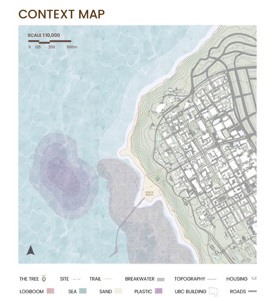
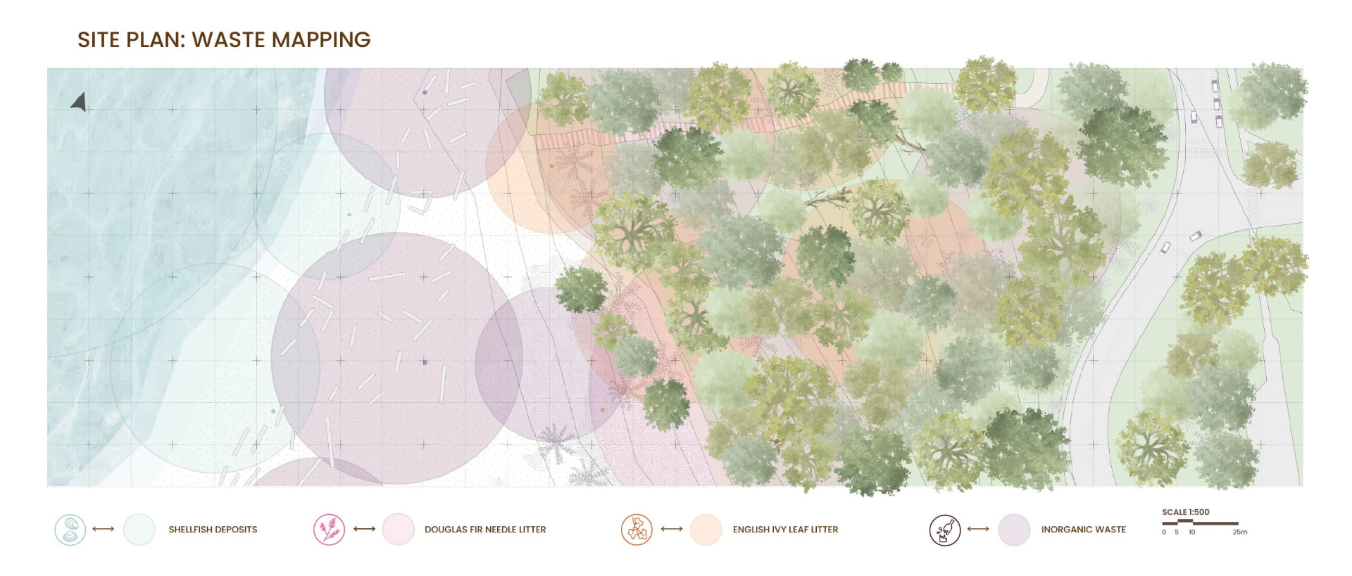
A 1:10,000 context map locates the site against the UBC campus, breakwater, and log boom, and a 1:500 site plan maps where shellfish deposits, Douglas fir needle litter, English ivy leaf litter, and inorganic waste accumulate.
Inorganic waste sources
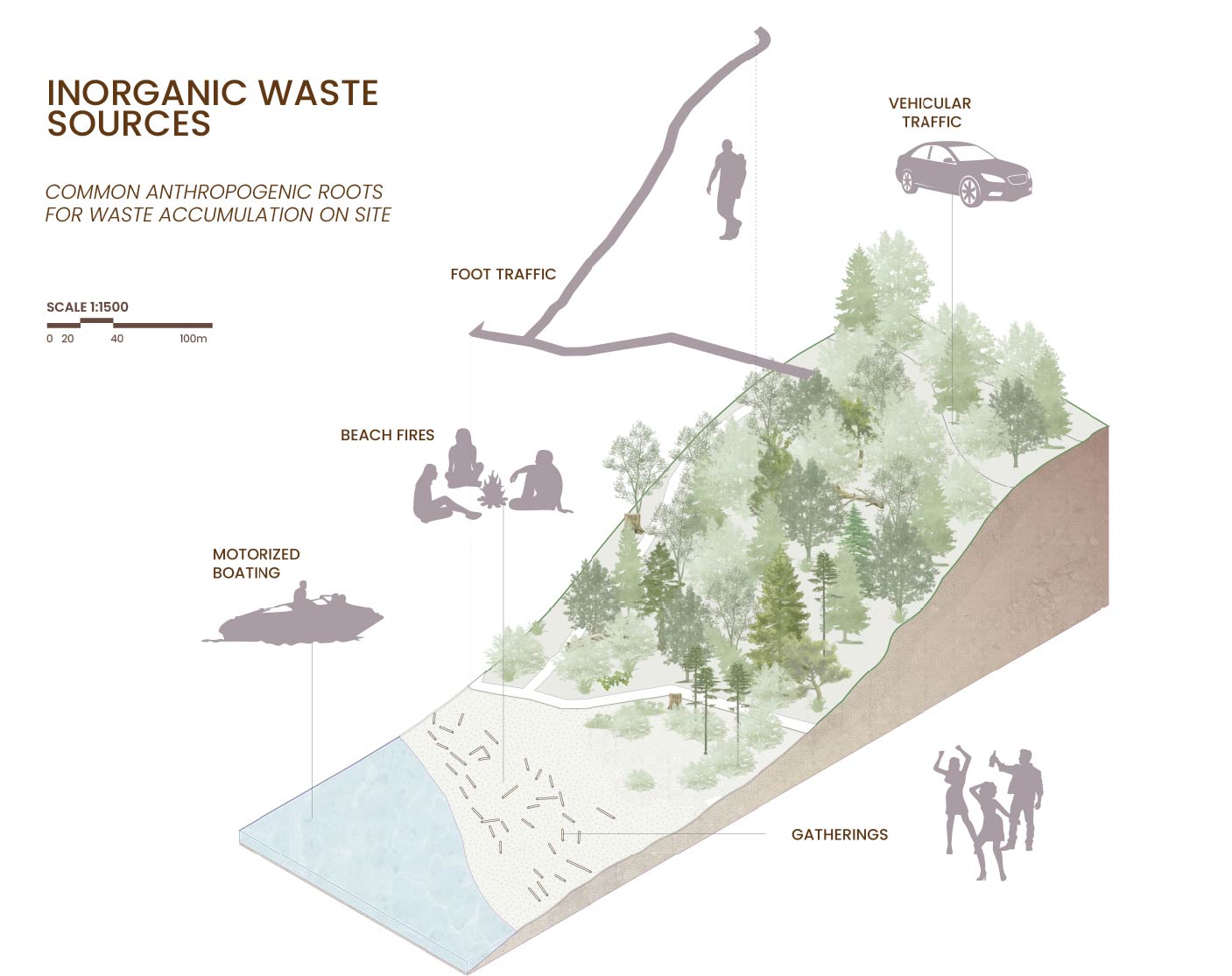
A site axonometric at 1:1500 traces the anthropogenic roots of accumulation on site: foot traffic, vehicular traffic, beach fires, motorized boating, and gatherings.
Waste presence timeline
A longitudinal elevation at 1:500 plots the relative presence of each waste type against site history, from glacial deposition and Musqueam stewardship to campus construction, log booms, gravel dumping, and projected climate futures.
Decomposition and material analysis
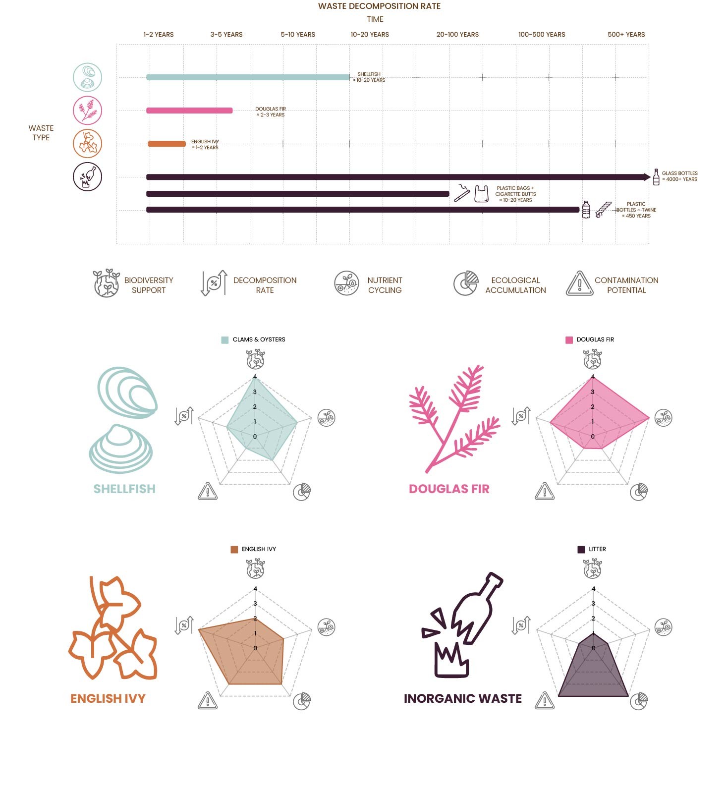
A transverse elevation reads native and invasive species against soil pH, paired with decomposition rate charts comparing shellfish, Douglas fir, English ivy, and inorganic litter across biodiversity support, nutrient cycling, and contamination potential.
- Year
- 2025
- Course
- DES 302
- Location
- Wreck Beach, UBC, Vancouver, BC
- Program
- Site analysis - organic and inorganic waste cycles
- Tools
- Rhino, Illustrator, Photoshop, InDesign
- Collaborators
- Dayson H., Hannah J.