The Unseen
- Year
- 2025
- Course
- DES 302
- Location
- Gastown, Vancouver, BC
- Program
- Urban site analysis
- Note
- Scale bars are not applicable
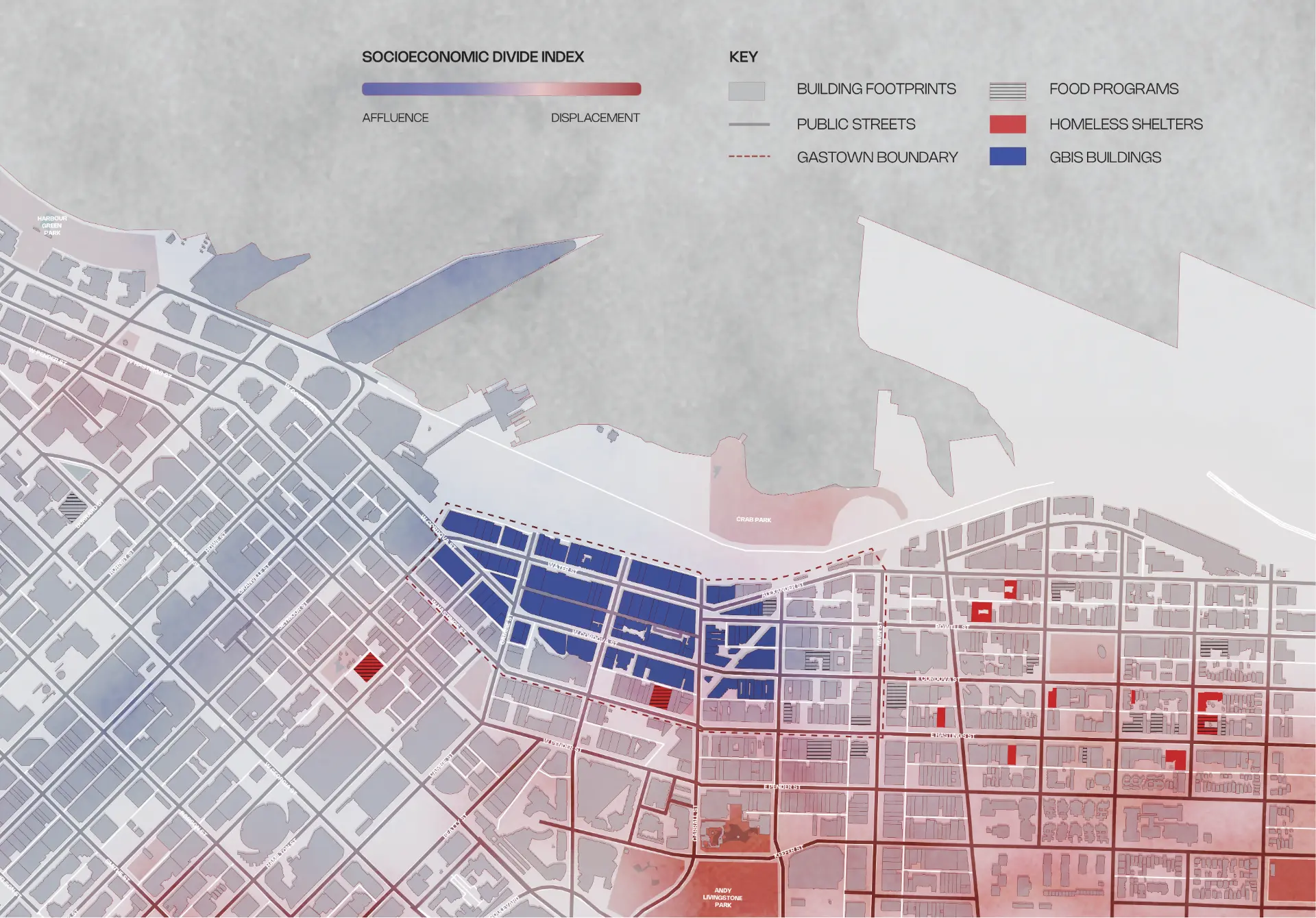
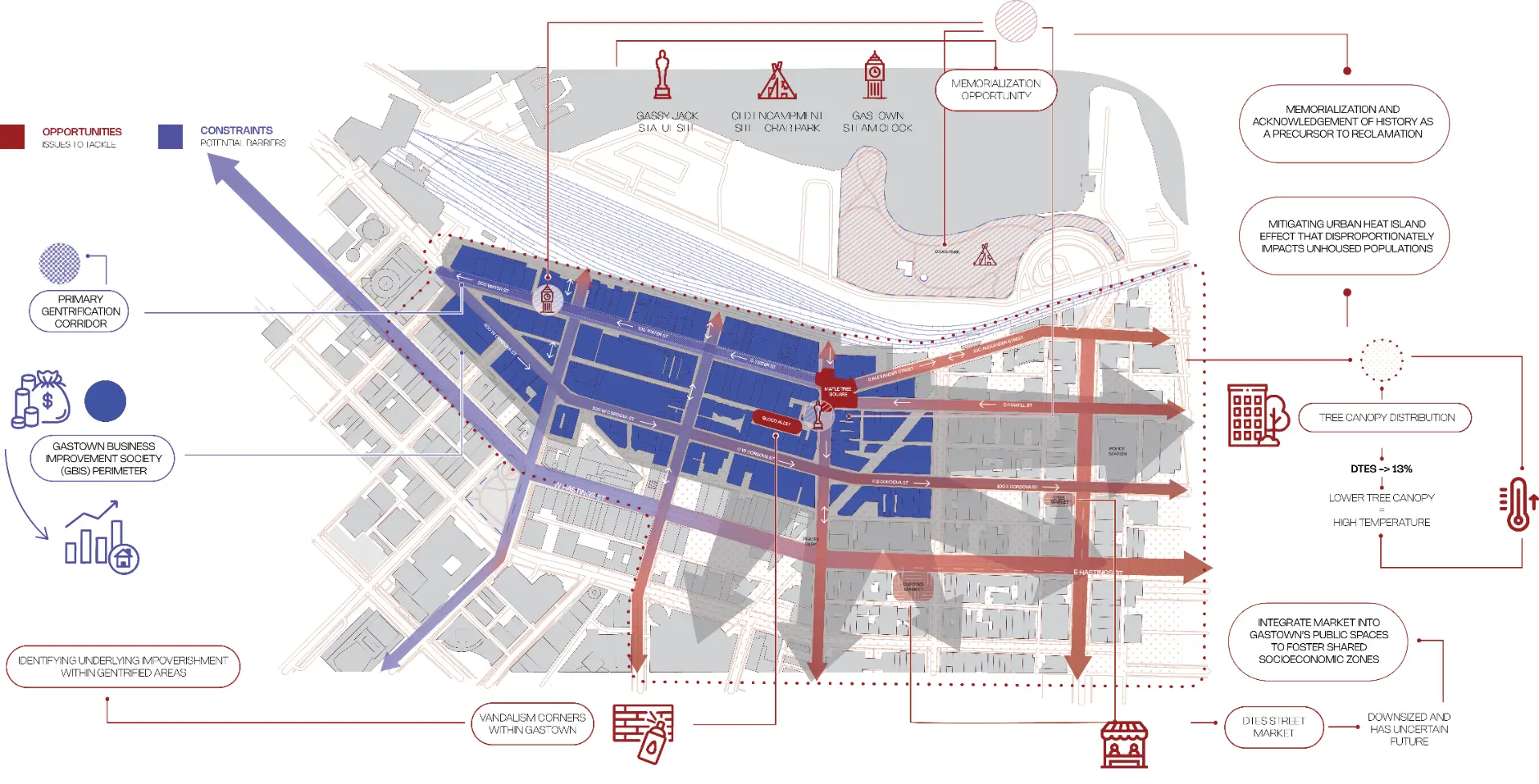
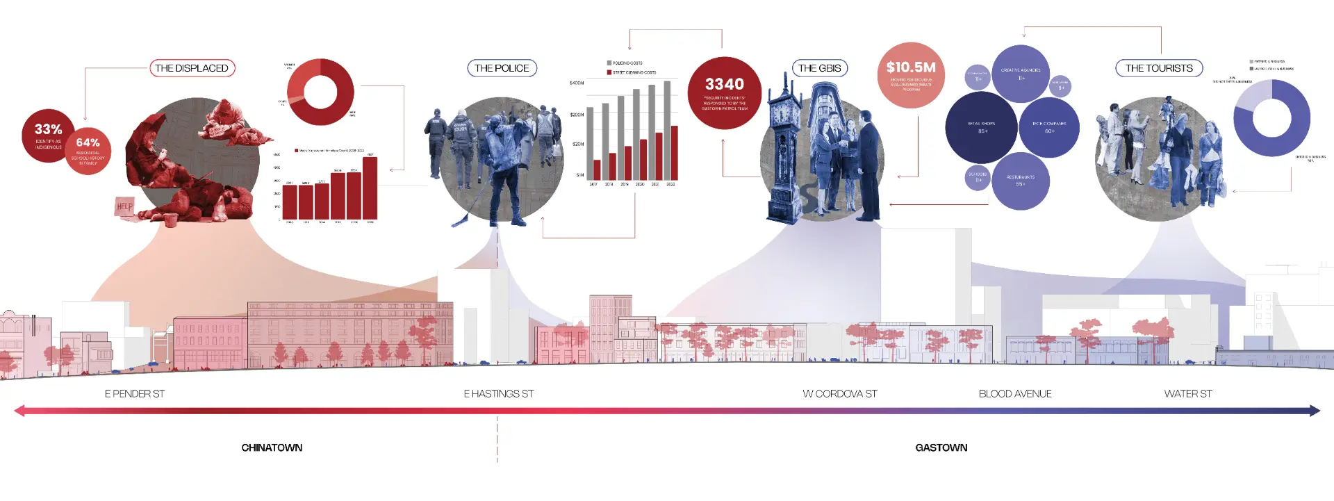
Gastown is drawn as a heritage district and lived as a boundary. This analysis reads the neighbourhood through the divide between affluence and displacement - who is served, who is policed, and who is designed out. Blue marks capital and tourism, red marks displacement, and the sections track how the two meet along Water, Cordova, Hastings, and Pender.
Socioeconomic divide index
A context map indexing affluence against displacement across Gastown, Chinatown, and the Downtown Eastside, overlaid with GBIS buildings, homeless shelters, and food programs.
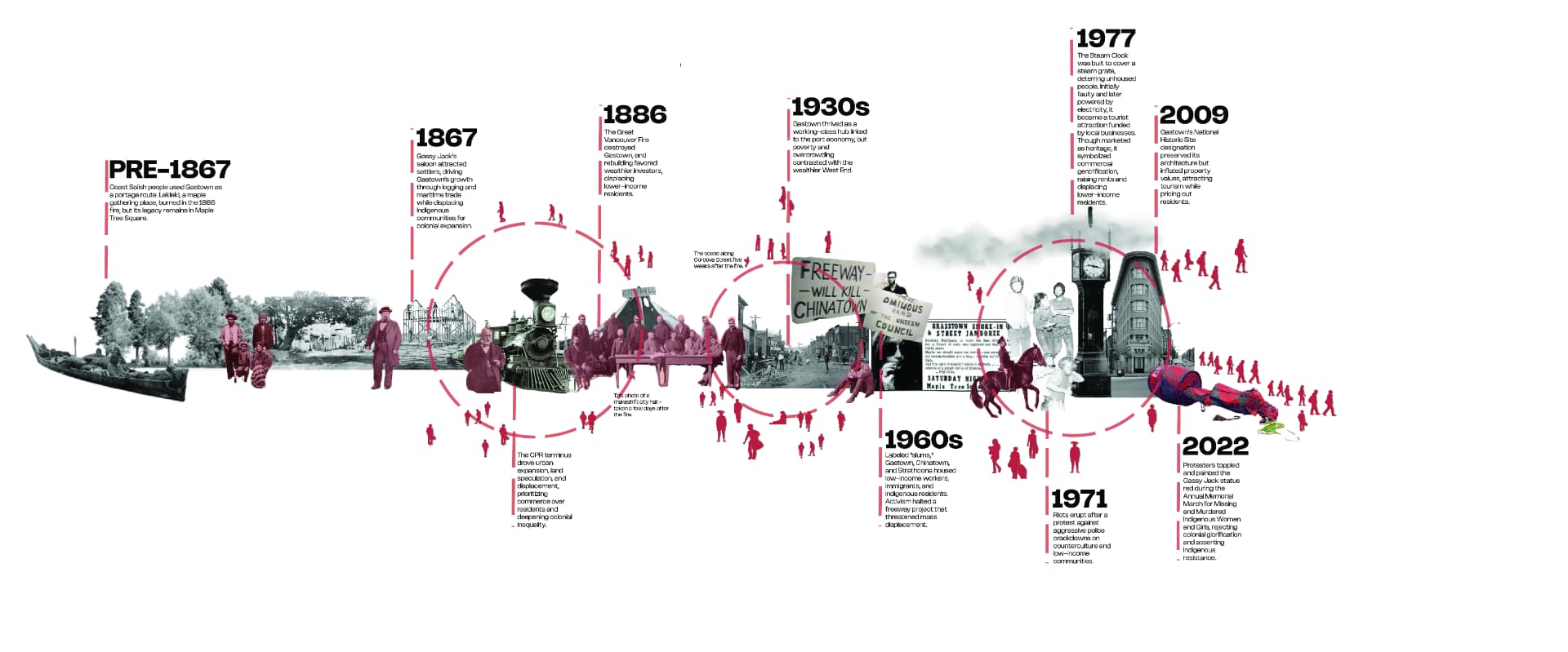
Gastown timeline
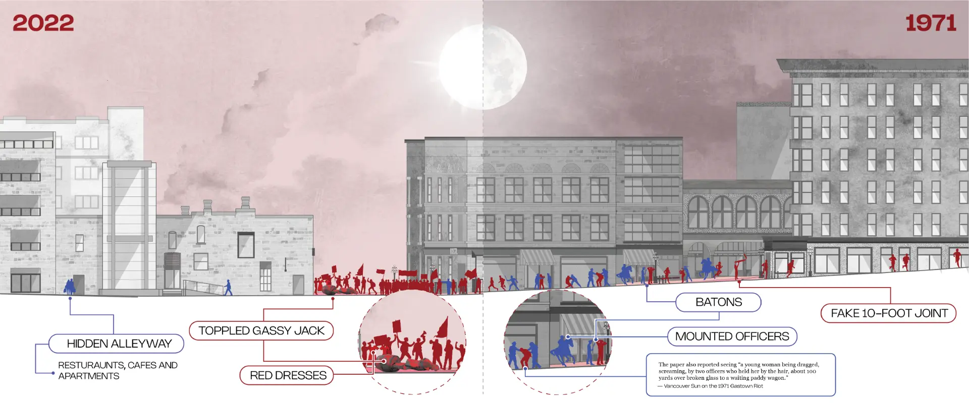
From pre-1867 Coast Salish portage routes through the 1886 fire, the 1971 riot, and the 2022 toppling of the Gassy Jack statue - a record of displacement repeating under new names.
Reading the divide
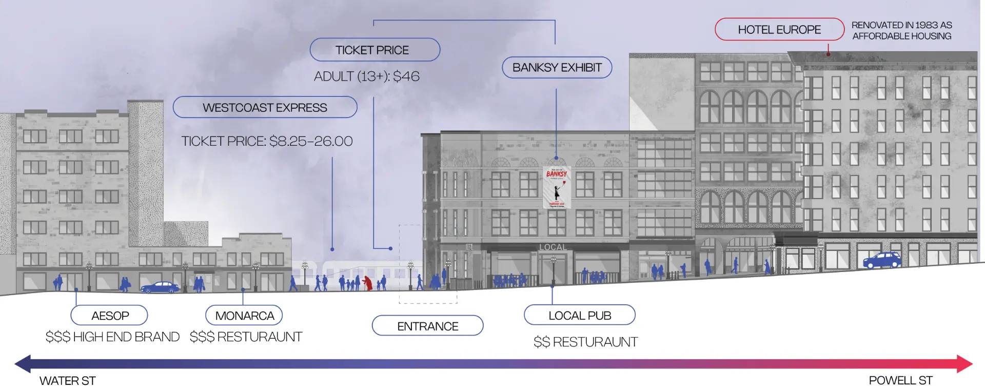
A long section across Pender, Hastings, Cordova, Blood Alley, and Water Street sets the displaced, the police, the business improvement society, and the tourists against one another; paired historical and modern sections compare 1971 with 2022 and the commercial frontage of Water Street today.
Maple Tree Square
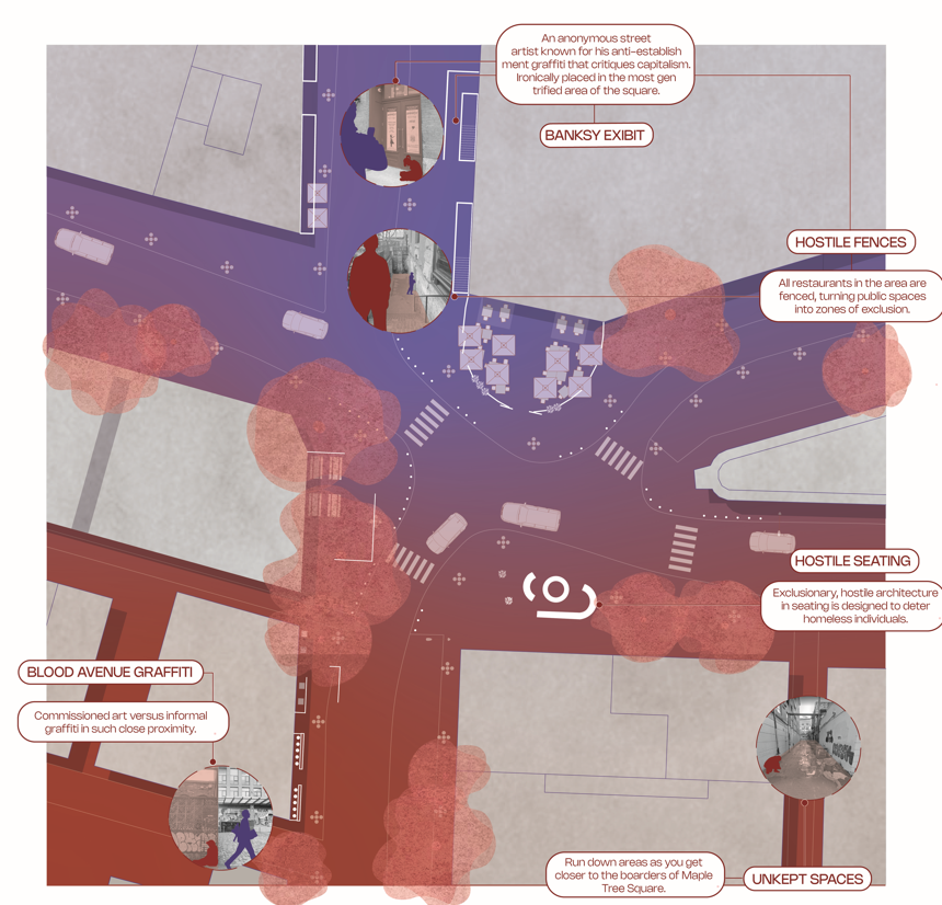
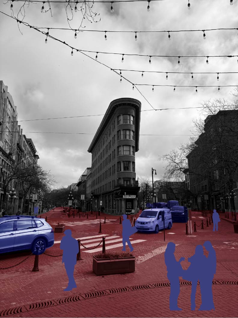
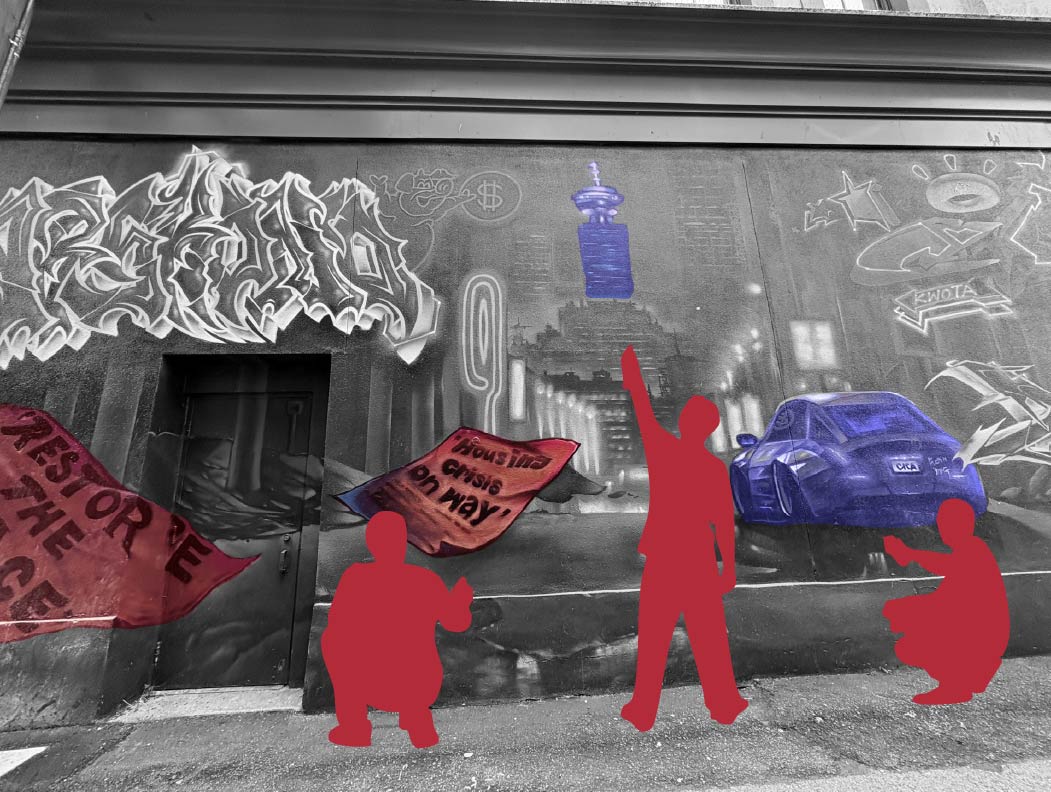
A plan of the square maps hostile seating, fenced patios, unkept edges, and commissioned art beside informal graffiti; photographs record the same conditions at eye level.
- Year
- 2025
- Course
- DES 302
- Location
- Gastown, Vancouver, BC
- Program
- Urban site analysis
- Tools
- Rhino, Illustrator, Photoshop, InDesign
- Collaborators
- Yumnna H., Winnie Z.